
ISSN (0970-2083)
ISSN (0970-2083)
G.P. Sathish1* and K. Saravanan2
1Department of Architecture, Sri Renugambal College of Architecture, Vellore, T.N., India
2Department of Chemical Engineering, Kongu Engineering College, Kongu, India
Received date: 17 October, 2013; Accepted date: 12 December, 2013
Visit for more related articles at Journal of Industrial Pollution Control
This study provide guidelines for the sustainable use and conservation of biological diversity and for the improvement of the relation between people and their environment globally. Sanctuaries, National parks and Biosphere Reserves are considered as protected areas. There are 13 Biosphere Reserves in India. The program of Biosphere Reserve was initiated under “The man and Biosphere (MAB) “program by UNESCO in 1971. Biosphere Reserves are areas of terrestrial and coastal or marine ecosystem, or a combination thereof, which are internationally recognized for promoting and demonstrating a balanced relationship between people and nature. This paper focuses on environmental planning of Gulf of Mannar Biosphere Reserve which extends from Rameswaram Island to Tuticorin. There are 21 islands running almost parallel to the coastline of Gulf of Mannar. It spreads over an area of 10500 sq. km having 3600 species of flora and fauna.130 species of corals are found here. This study provides a guideline for sustainable use of resources, activities to be permitted along coastal stretch, coastal highways, and mangroves, reclamation of saline and alkaline soil, coastal pollution, sedimentation, avifauna, settlements, tourism and recommended vegetation.
Eco system, Bio diversity, Corals, Mangroves, Flora, Fauna, Avifauna.
The coastal environment is very dynamic with many cyclic and random processes owing to a variety of resources and habitats. Further the coastal ecosystems are one of the most productive ecosystems on earth. About 60 percent of the world population lives near the coast and in one way or other depends directly or indirectly on the coastal zone and its resources. Thus the coastal zone plays a vital role on the nation’s economy. As a result of increasing human population and the trend for a greater proportion of people to live close to the sea, the economic activities on coastal environment are also increasing. Hence there is an urgent need to protect the coastal environment and ensure its sustainable production and development. In India, Gulf of Mannar Marine Biosphere Reserve (GOMMBR) is a unique biosphere reserve in many respects. GOMMBR covers an area of 10,500 sq. km and includes 21 islands of varying area ranging from 0.25 ha to 129.04 ha.
Factors like urbanization, population growth, industrial development, international trade, inadequate legislation, linear approach in resource utilization, tourism leading to habitat degradation, over-exploitation of resources are the known threats to the survival of unique life support system of the Gulf of Mannar Biosphere Reserve.
Objectives of the study
1. Obtain zones of suitability for preservation, conservation and development.
2. Identify the areas of immediate action along the coastal stretch
3. Segregate the zones and the activities allowable and frame requirements that will create awareness and educate public about the coastal marine ecosystem.
4. Frame guidelines for sustainable usage of the coastal marine resources and recommend vegetation along this coastal stretch.
5. Frame guidelines for coastal pollution, sedimentation, settlement, coastal erosion.
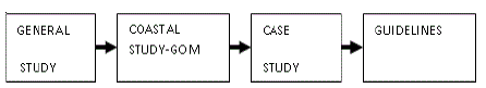
The framework of environmental planning of Gulf of Mannar Biosphere Reserve is shown in Fig. 1.2
General Study
The general study includes the study of Protected Area Network, function of Biosphere Reserves, Zoning in Biosphere Reserves and Coastal Marine Ecosystem. Core zone is a chain of 21 uninhabited islands which is a Strictly prohibited area, conservation and monitoring are the functions allowed. Buffer Zone is a strictly delineated area, which is comprised of Gulf waters to the south and an inhabited coastline to the north. The allowable functions are research, education and tourism and activities that are managed to protect the core zone. The Transition Area is the Outer area of the buffer zone; functions allowable are human settlements, research station, traditional use, education, training, tourism, recreation rehabilitation, facilities for research.
Coral reefs are a distinctive shoreline habitat of stunning visual appeal found only between latitudes 30°N and 30°S. They grow only where sea surface temperatures are above 20°C. Most living coral communities do not grow at depths of more than 50m although some grow at depths of 100m. They are considered the most productive marine ecosystem, supporting as many as 3,000 species. Coral reefs form the most dynamic ecosystem providing shelter and nourishment to thousands of marine flora and fauna. Coral reefs acts as a critical resource for various environmental and economical activities. Coral reefs provide an ideal habitat and feeding ground for various marine animals. Coral reefs act as a bulwark against cyclone, erosion, protects coastal installation and beaches. It provides a feeding ground and habitat for various marine animals. Coral reefs absorb CO2 and convert it to CaCO2 and reduce the CO2 in the atmosphere. Coral reefs and sea grasses are interconnected ecosystems. Sea grasses provide feeding ground for babyish marine species while coral reefs feeds adult species .
Mangroves are termed as tropical tidal wetlands with typical vegetations distributed along the border of the sea and lagoons reaching upon the edges of the rivers to the point where the water is saline and growing in swampy soils covered by the saline water during high tides. They play a role in preventing soil erosion even during tsunami. They are salt tolerant forest ecosystem found in the inner tidal regions. The major threats for mangroves are hyper salinity, siltation, tree felling for timber and firewood, human inhabitation and pollution, embankment construction, aquaculture, grazing by cattle/goat, over exploitation of juvenile fishes, disease, natural calamities (cyclone, storm and flood). The factors that influence mangroves are temperature, tides, salinity, rainfall and winds. Mangroves are under pressure due to salt pan conversions, development of ports, aquaculture, increase in population, dumping of industrial waste and their effluents leading to loss of mangrove ecosystem.
Sea shells are the marine living organisms which belong to the family called Mollusca. Commercially many ornamental items are made from these shells. Collection, possession and trading of these marine living organisms and their products are happening in this coastal stretch.
Seaweeds are marine algae. They occur in the inter-tidal and sub-tidal regions of the sea. They are very important marine living resources. They are the only source for the production of photo chemicals which are used in food industry, textile industry, paint industry etc. Over exploitation of seaweeds indirectly affects the coral reef ecosystem, as a result of increasing siltation in sea water. Seaweeds act as a protective barrier against the wave action. Reduction in seaweeds leads to coastal erosion and removal of coral reefs.
Ship wreck is regarded as an artificial reef that harbours corals, fishes and other fauna. Artificial reefs are beneficial in reef conservation and rehabilitation efforts .
Coastal Study
GOM – As a Biosphere, Physical Study, Islands, CRZ Classification, Geology and Geo-Morphology, Coastal Morphology, Vegetation, Coastal Highways, Visual Quality, Coral Reefs, Physical Features, Overlays, Overlay Inference, Zones of Suitability.
GOM is bounded by Palk Bay and Rameswaram Island in the north, Ramanathapuram district in the North West and west, Tuticorin district in south and Bay of Bengal in the east.
The climate is tropical and it comes under the spell the rivers is from northwest to southeast. Vaigai and Vaippar are the biggest rivers in the Gulf of Mannar.
There are 21 islands ( Fig. 2) lying off the coast in Ramanathapuram and Tuticorin districts Fig 2. Most of the islands are of coral origin. The 21 islands have an area of 623 hectares. Kurusadi Island is generally called as biologist’s paradise, because of the richness of variety of fauna and flora. There is lush growth of mangrove vegetation with different species. Extensive coral reefs are present here. Large number of sea birds visits these islands. Dense coconut, acacia, Palmyra trees are found here. Commercial exploitation of seaweeds is done here. Illegal mining of coral reefs are done here. Coastal erosion is found on most of the islands. One of the major threat is Sethusamudram Ship Canal Project which cause drastic changes to the biodiversity of the region and also cause major impacts and losses of fisheries and livelihoods to the region. Marine biodiversity can be increased by trained taxonomist.

Figure 1: Map of Gulf of Mannar Biosphere reserve

Figure 2: Gulf of Mannar Coastal Morphology
CRZ - 1: Most of the coastal stretch in this area comes under this zone – Pamban coast, Kilakarai coast etc
CRZ – 11: Substantially developed coast - Tirttakkarai coast, Sayalkudi coast etc. CRZ -111: Remaining coastal areas come under this zone.
Coastal Highways are NH – 49 (Madurai to Rameswaram) ,ECR – phase 11 (Cuddalore to Tuticorin). At Keelakarai the proposed ECR comes very closer to the HTL. At Pamban the highway is very close to the shoreline. This will affect the coastal marine resources.
Preservation zone are of a landscape character deserving complete preservation as a nature preserving. People depending on this zone should be educated so that they won’t disturb corals, mangroves.
Conservation zone are less sensitive or less productive areas are suited to limited use. Natural features will be conserved and protected in and around these areas with movement of pathways taken care of to bring people and nature into compatible relationship.
Development zone are the natural landform and vegetation are of minimal significance. Facilities for ecotourism should be developed only in this zone.
A. Guidelines for sustainable resources management
Periodical monitoring and research of presence of the coral reefs has to be done to distinguish the growth of the coral reef. Biologist’s paradise “Kurusadi Island” comes under core zone. ( Fig 3 ) Coral mining is strictly prohibited here.

Figure 3: Gulf of Mannar Coral reefs near Kurusadi Island
Dumping of solid waste near Mandapam fishing village has to be stopped. Traditional fishing is allowed in buffer and transition zones.Commercial fishing is to be banned. Sea route for tourism or trade should be obtained by careful monitoring.
B. Guidelines for coastal highways
At Pamban, Causuarina is to be planted on either side of ECR which acts as wind breakers ( Fig. 4).

Figure 4: Coastal highway
C. Guideline for mangrove
Conversion of mangroves into salt pans should be stopped. In some areas restoration is possible. Here the soil has to be treated to reduce the salinity and then plantation of mangroves species is to be done. Fire wood collection in Kurusadi is to be banned. To protect the islands, re-vegetation of mangrove species has to be done.
D. Guidelines for reclamation of saline-alkali soils
Salinity tolerant and alkali tolerant plants can be grown without any reclamation. The soil conditions can be improved so that the salt content is reduced.
E. Guidelines for coastal pollution
The industrial effluents of Tuticorin alkali chemical, SPIC Ltd – Tuticorin, DCW Ltd – Tuticorin, Thermal power station; before it gets mixed with the River Vaiper, River Vembar and River Kallar should be treated properly (Fig. 5). No new industrial development on the eastern side of Tuticorin. Industrial growth is allowable on the southern side of Tuticorin. No further new industrial development on the seaward side near Tuticorin should be allowed.

Figure 5: Coastal pollution
F. Guidelines for Sedimentation
In Tuticorin and Mandapam coastal areas the cyanide poisoning method of fishing is to be banned. Traditional fishing methods should be encouraged in all the coastal villages of Gulf of Mannar. Commercial fishing methods should be totally banned in the core and the buffer zones. Conversion of mangroves and marsh vegetation into salt pan in Tuticorin and in Valinokkam should be stopped and this can be allowed south of Tuticorin. Over fishing in Mandapam region should be controlled. All the industrial effluents should be treated properly before it gets mixed with River Vembar and River Vaiper.
G. Guidelines for Settlements
At Pamban region, the huts are very close (within 25m) to the high tide line. These settlements are to be relocated towards the south of Mandapam fishing village. At Kilakkarai region, the drainage from encroachment settlements gets mixed with seawater and this will affect the coral reef (Fig. 6). Proper settlements can be provided for these encroachments in the southern side of Kilakkarai region.

Figure 6: Settlements
H. Guidelines for Avifauna
To improve the bird habitats in Manoli and Appa islands, tree species like Barrington, Acacia, and Pongamia should be grown. For revegetation of mangrove, species like Avicenia marina, Lumnitzera racemosa are to be planted in these islands.
I. Guideline for Coastal erosion
Protective measures are taken either by structural works or afforestation. Casuarina should be grown to control wind erosion.
J. Guidelines for Tourism
The environmental movement has intensified the relationship between nature and tourism resulting in a form of nature tourism with an ecological bias called as the eco-tourism. Framing requirements for creating awareness about this biosphere reserve are Glass bottomed boat club, Nature trail or beach teach walk, View towers, Research trips, Field study centre in Kurusadai island, Interpretive centre on the GOM and its biodiversity, Oceanarium, Aquarium, Museum, Scuba diving school, Snorkelling, Bird watching, Eco beach resort ( Fig. 11) etc.
K. Guidelines for Recommended vegetation
Recommended road side plantation are Albizzia lebbek, Azadirachta indica, Spathodea companulata, Peltophorum, Samanea Saman, Terminalia arjuna, Pongamia glabra, Thespecia populnea, Kigelia Pinnata, Alstonia Scholaris, Tectona Grandis, Terminalia catappa, Parkia biglandulosa. Recommended vegetation for highly saline soil (Tuticorin region) are Azadirachta indica, Pongamia glabra, Atriplex ripens, Dalbergia sissoo, Casuarina equisetifolia, Butea monosperma.
L. Overlays
The overlays are given in (Fig. 7, 8,9,10)

Figure 7: Overlay with respect to mangroves

Figure 8: Overlay with respect to Coral reefs

Figure 9: Overlay with respect to Shell areas.

Figure 10: Overlay with respect to Visual quality.

Figure 11: Ecotourism.
Areas of immediate action is shown in Fig. 12. The zones of suitability are shown in Fig. 13.

Figure 12: Areas of immediate action.

Figure 13: Zones of suitabiity.
The study helped to obtain zones of suitability for preservation, conservation and development and areas of immediate action. It also leads to framing requirements that will create awareness and educate public about the coastal marine ecosystem. The guidelines help to conserve the unique Gulf of Mannar marine biosphere reserve and also help for sustainable usage of marine resources.
Copyright © 2024 Research and Reviews, All Rights Reserved